How far? How long? How hard?
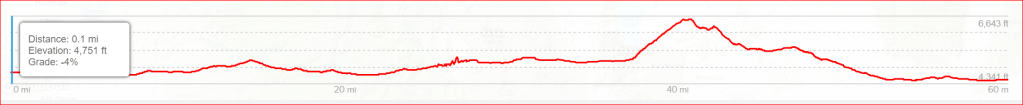
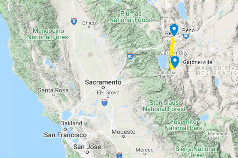
63 miles. 5 days/stages. Moderate difficulty. The route starts in Gardnerville, Nevada and ends in downtown Reno, Nevada (or reverse). Most of the walking will be on hard surfaces (city sidewalks, streets, roads). Some stretches will be on dirt roads and trails. Stages 1 & 5 are flat or gradual decline. Stages 2 & 3 include long gentle climbs. Stage 4 includes a moderately steep climb for 5 miles.
Some of the risks and dangers include high elevation (4500′ to 6600′ +/-), exposure to weather, including long stretches with no shade or water or bathrooms. Motor vehicle traffic is a risk because some days include walking on road shoulders for several miles (wearing high-visibility clothing is recommended). All of the risks associated with physical exercise and wilderness travel are present. Walkers must be self-reliant, well-prepared, and realistic about their abilities and limitations when undertaking this journey.
